Main Tuolumne Canal
Hike Review
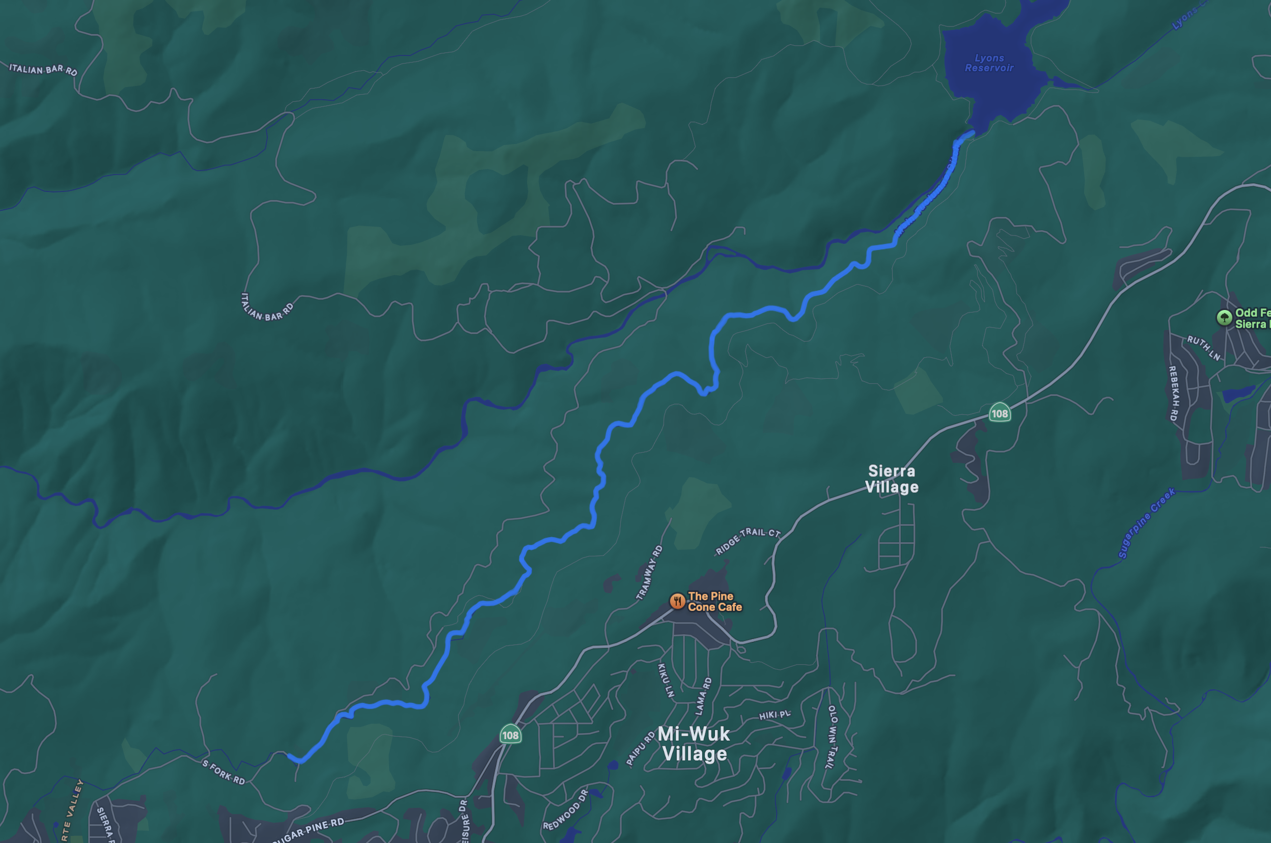
Cassie and I walked most of the Main Tuolumne Canal from near the town of Twain Harte to Lyons Dam. We saw a longer trail on AllTrails, but since we were walking in our sandals, we wanted to walk less than 10 miles if we could help it.
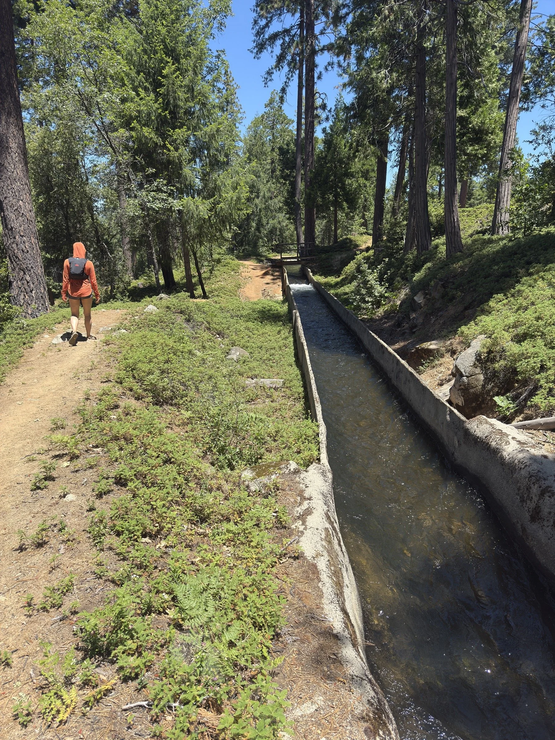
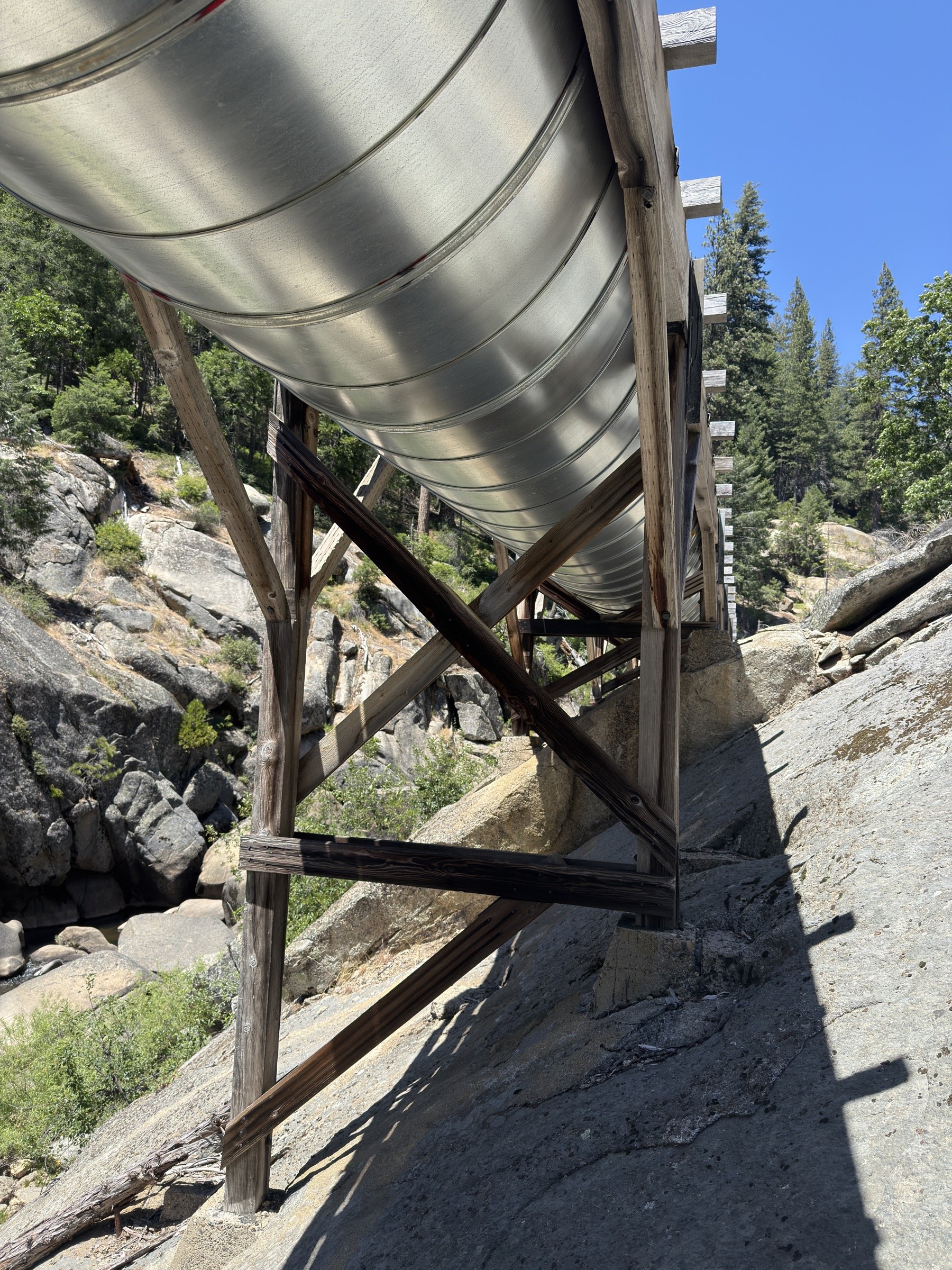
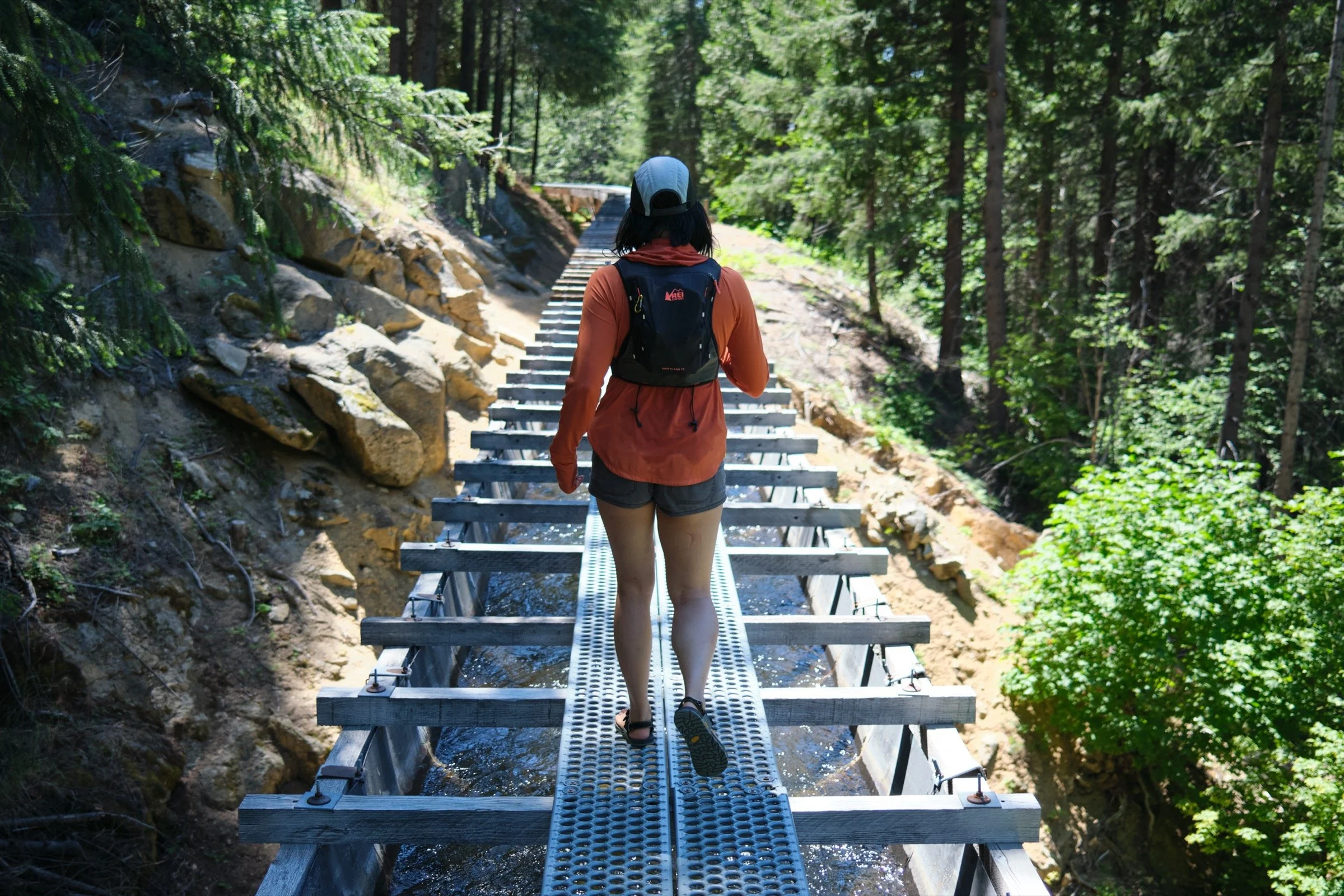
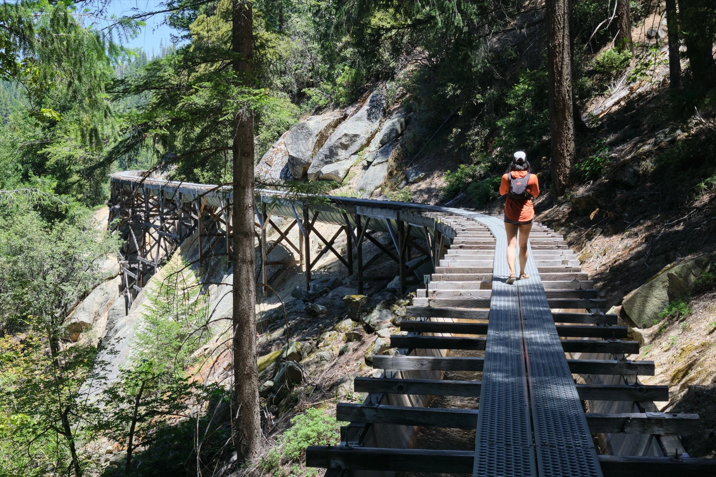
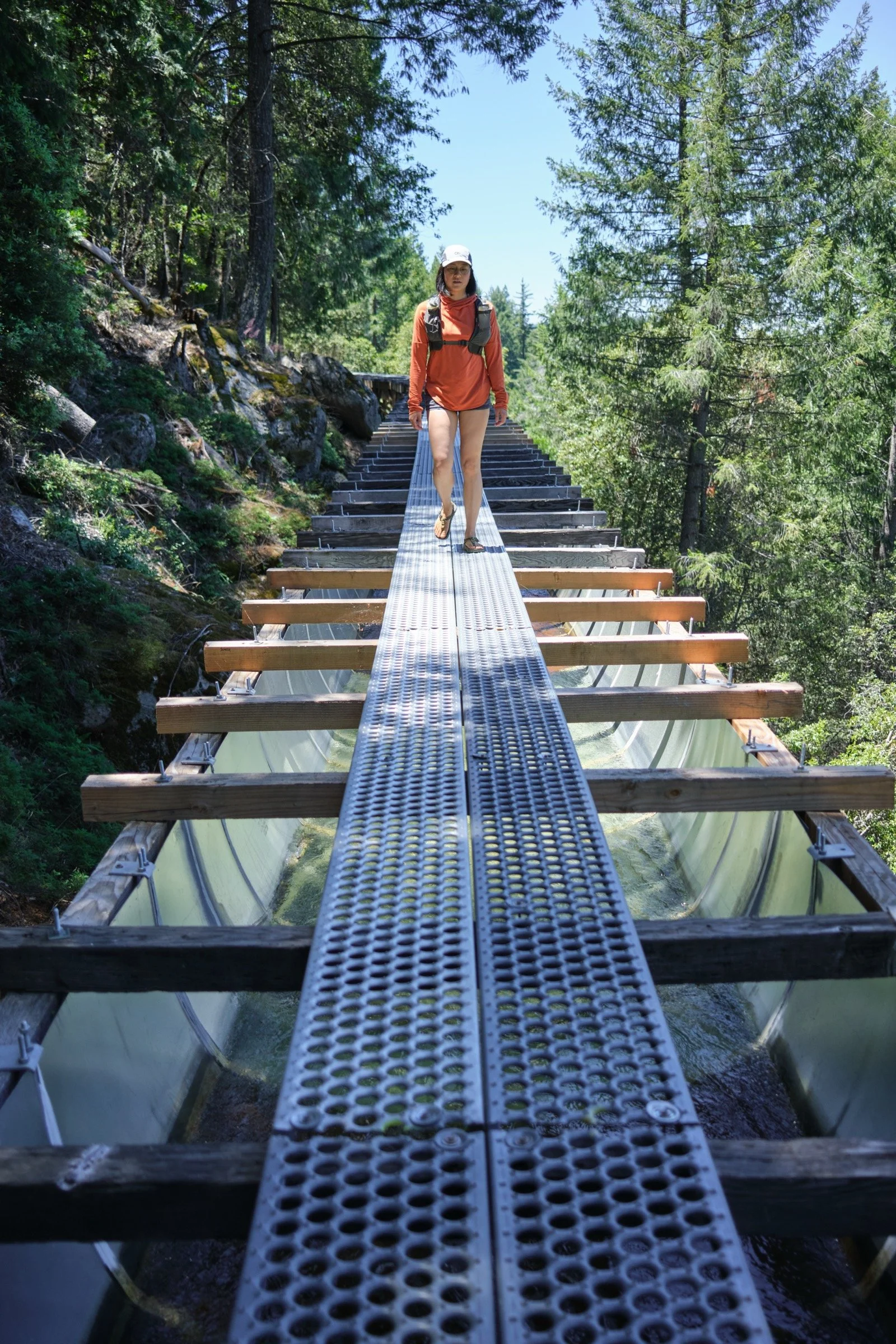
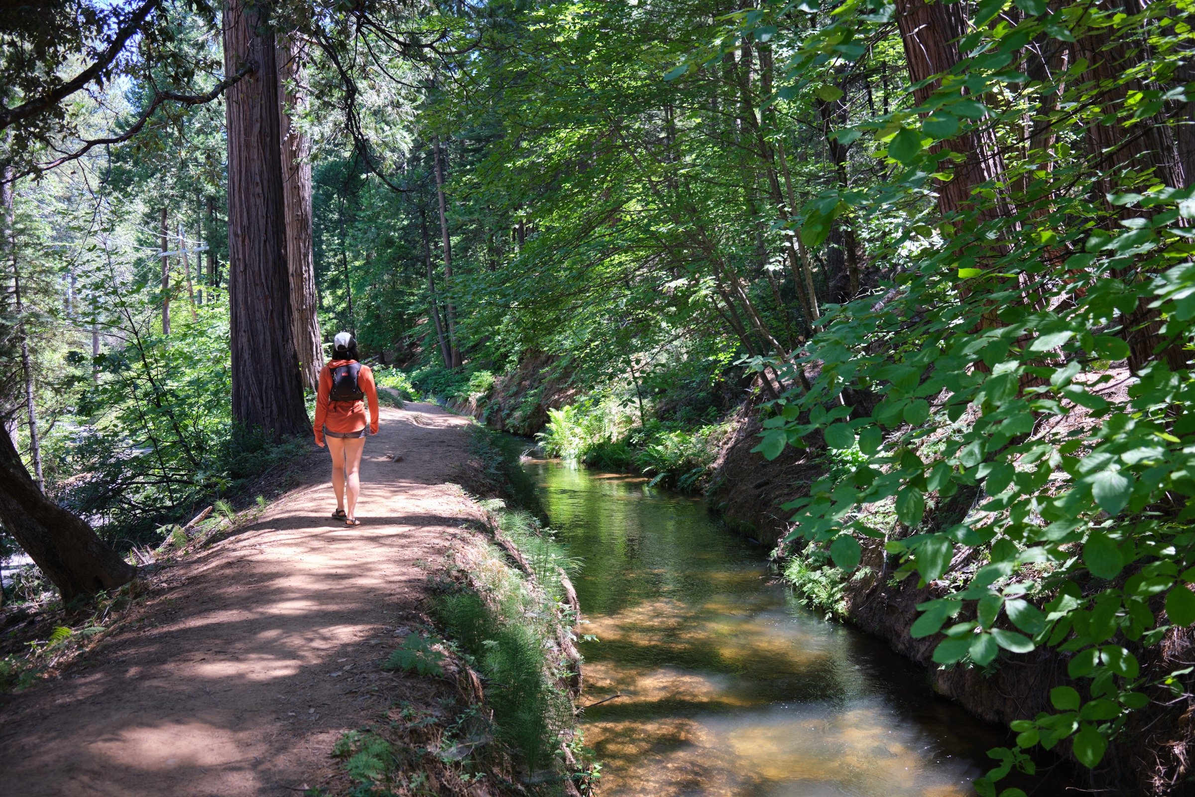
The Main Tuolumne Canal is super gentle in grade, so we barely noticed the elevation gain on the way up to the bottom of the Lyons Dam. About 40% of the trail (we think) was on top of the flume. The rest were on a trail next to the canal. Some of the sections where we had to walk on top of the flume were rather high off the ground (maybe 50’ high?). There are no rails, so we walked carefully in those sections. The flume sections were really built with one-way traffic in mind, and we were glad that we only had to pass one person who was sitting on the metal planks, as there is not much room to do so.
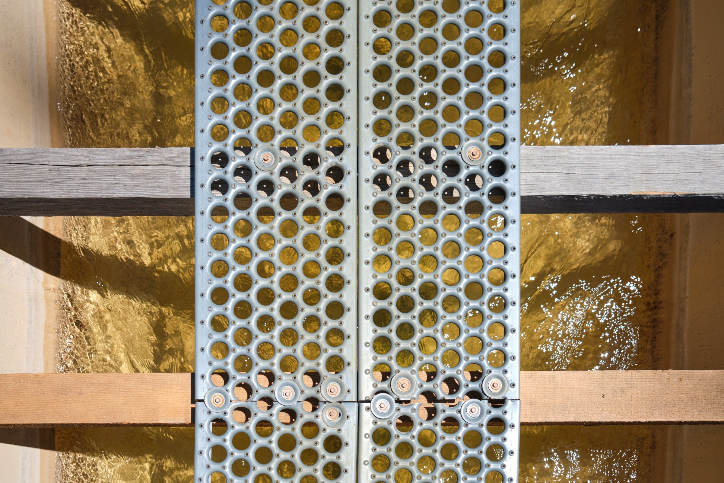
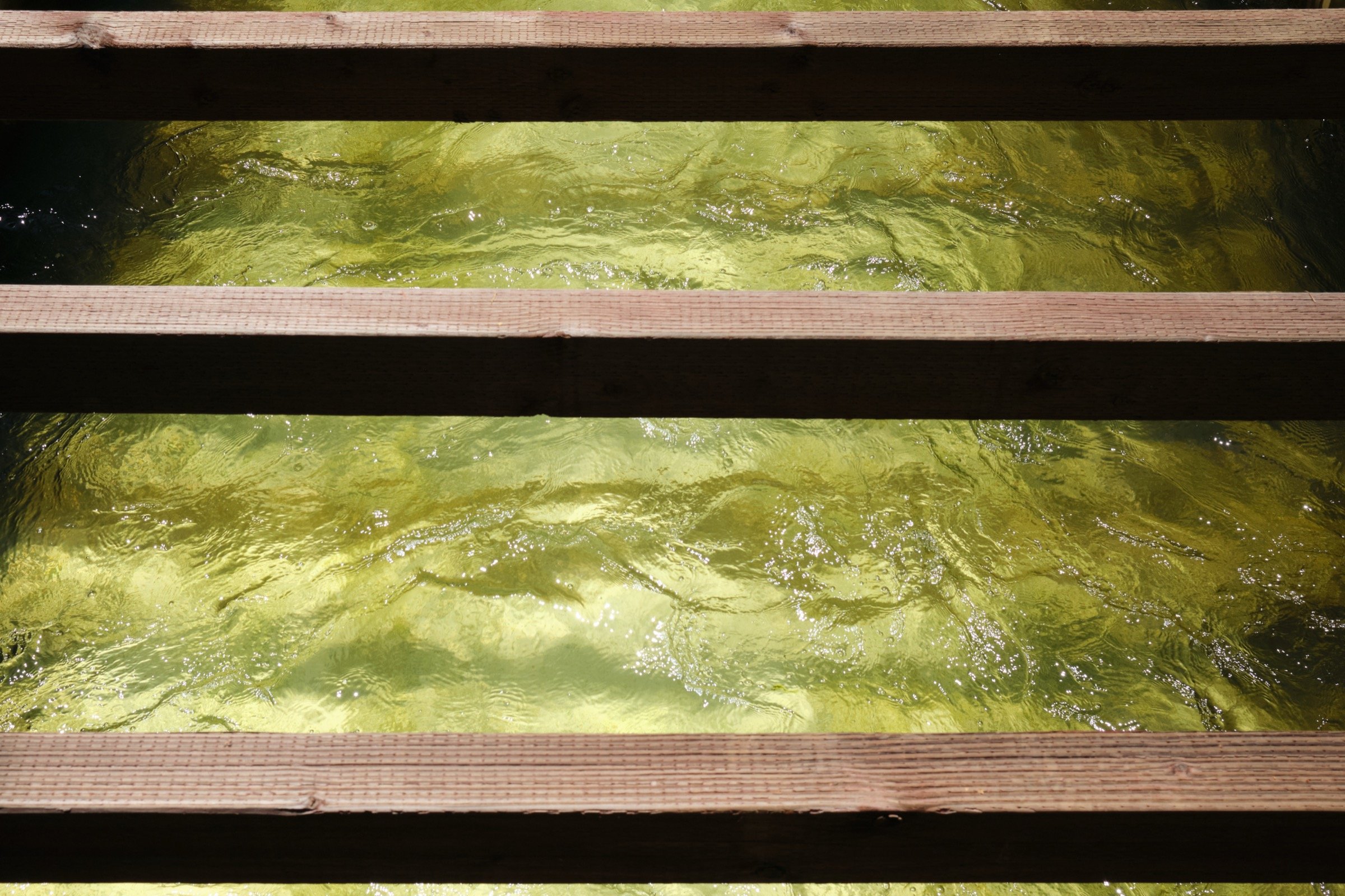
The sections where we walked on top of the flume mostly had metal planks. Maybe a quarter of it was wooden planks. Either way, the planks were solid and it felt like walking on a sidewalk.
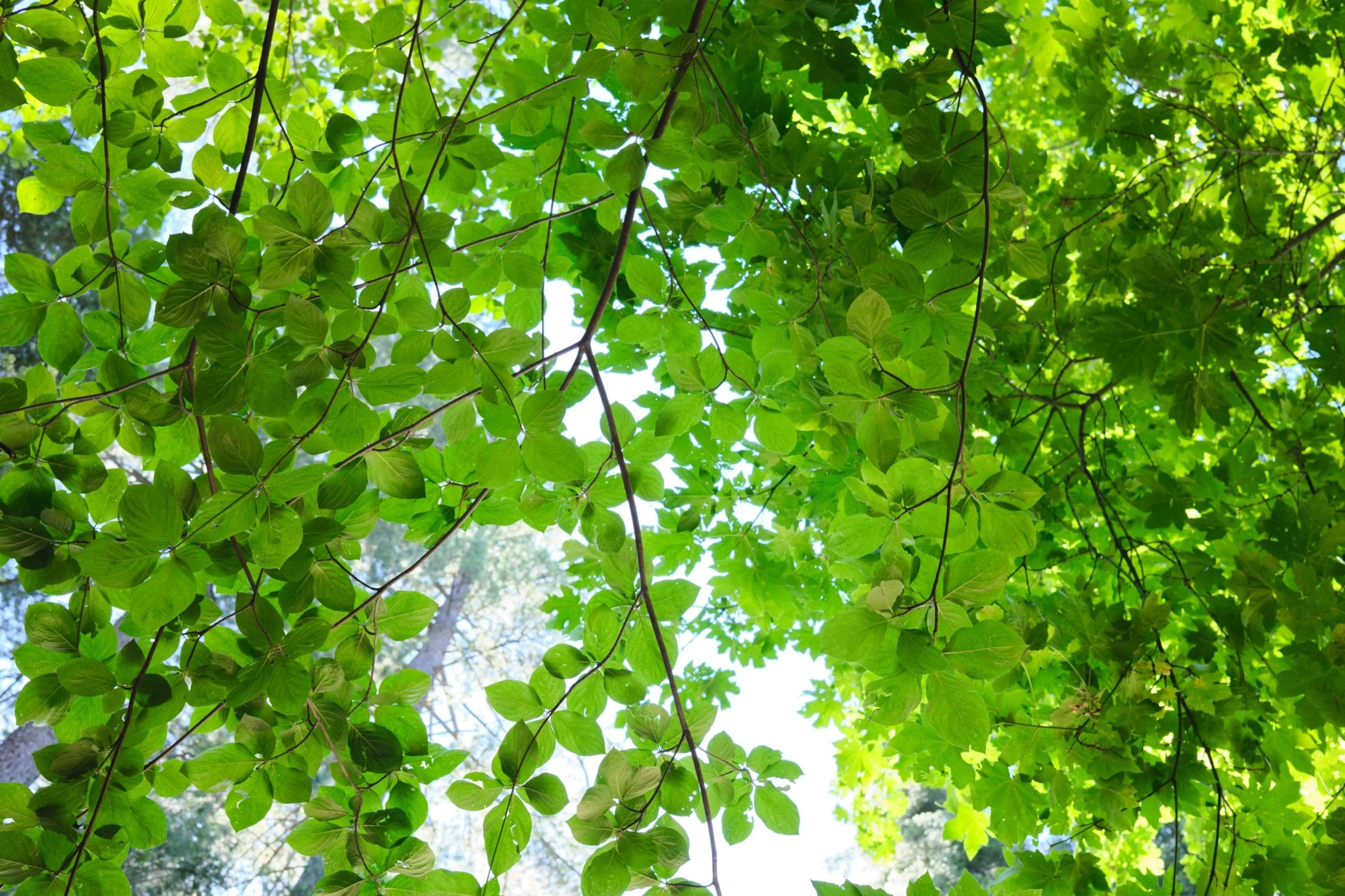
There was shade about 25% of the time with lots of trees near the town of Twain Harte and the last mile or so to the dam not having much shade at all.
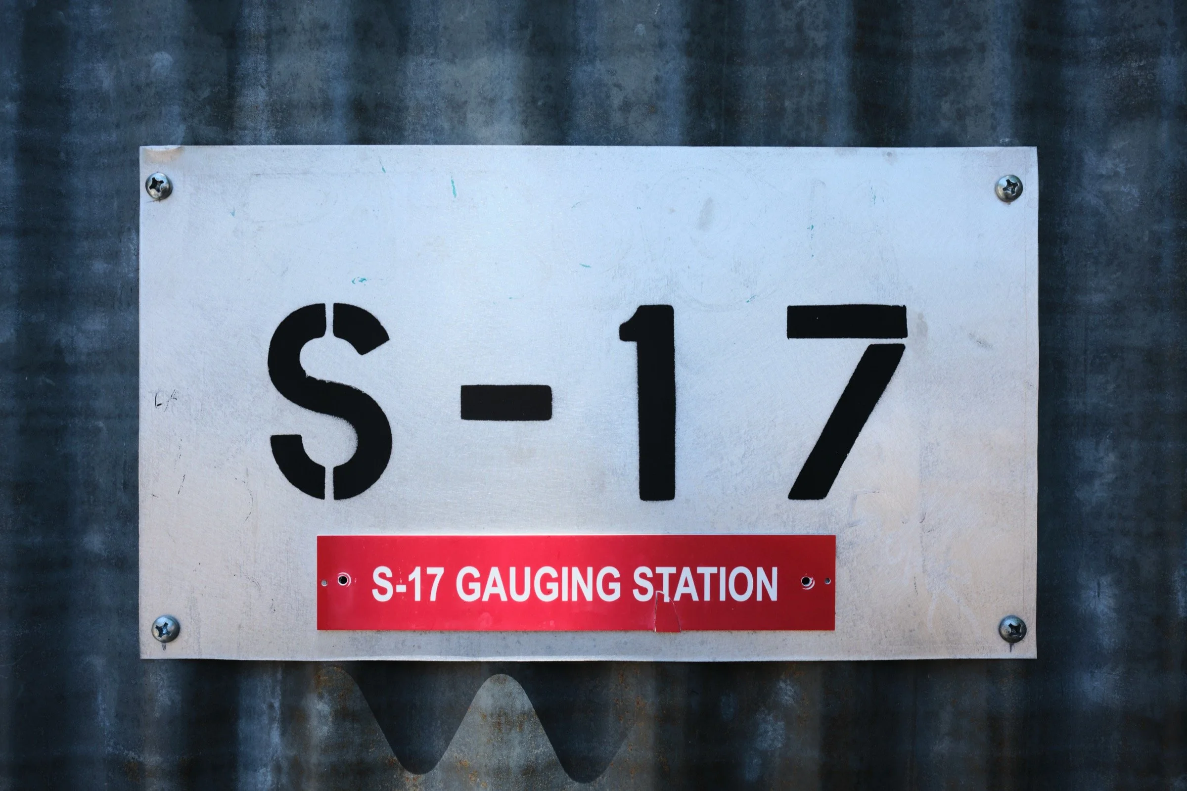
There are no restrooms. We parked on the side of the road and where we started had very few parking spots.
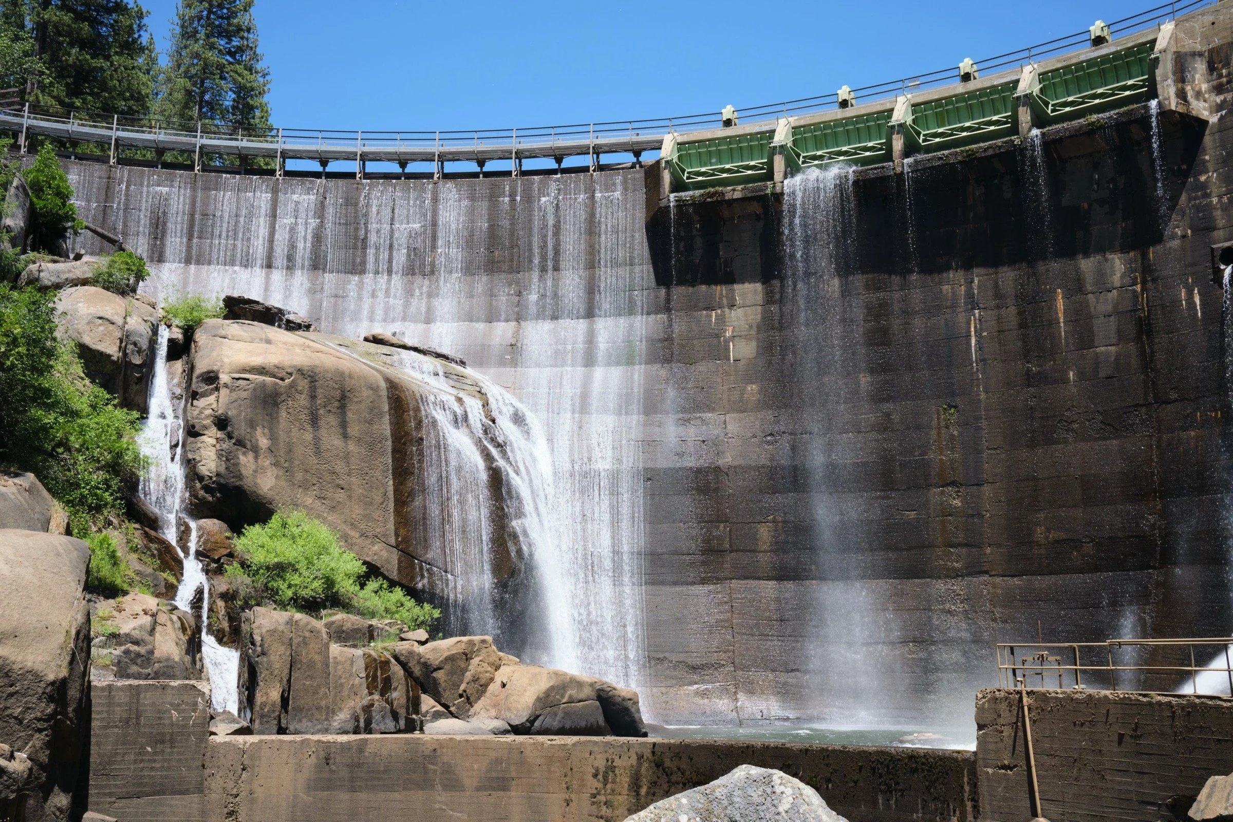
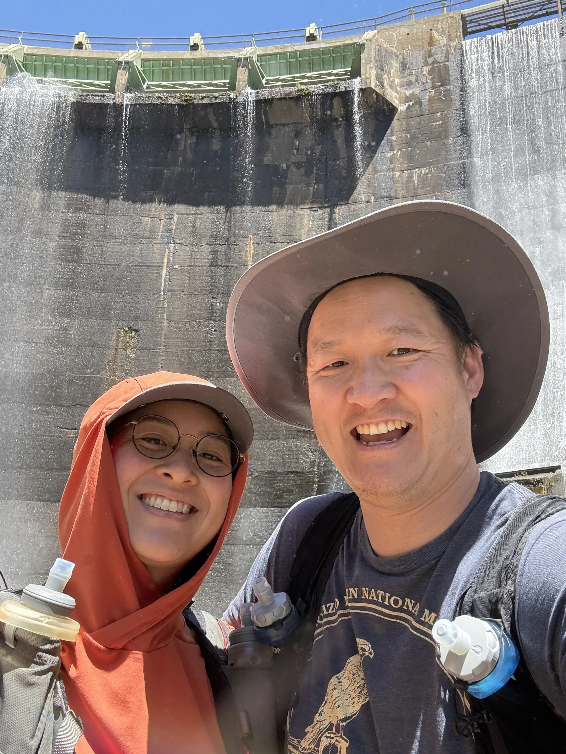
When we got to the dam, we were surprised to find that there was easy access (via a ladder) to get down to the creek. We were also able to walk up almost to the bottom of the dam and look up at the concrete structure from an extreme angle.
The walk on top of the flume was louder than a regular hike since the wooden and metal planks make more noise than a regular trail. However, kind of like a train, it’s a rhythmic sound that we got used to. The sound of the water was rather pretty, though it did get loud in parts where the water flowed faster.
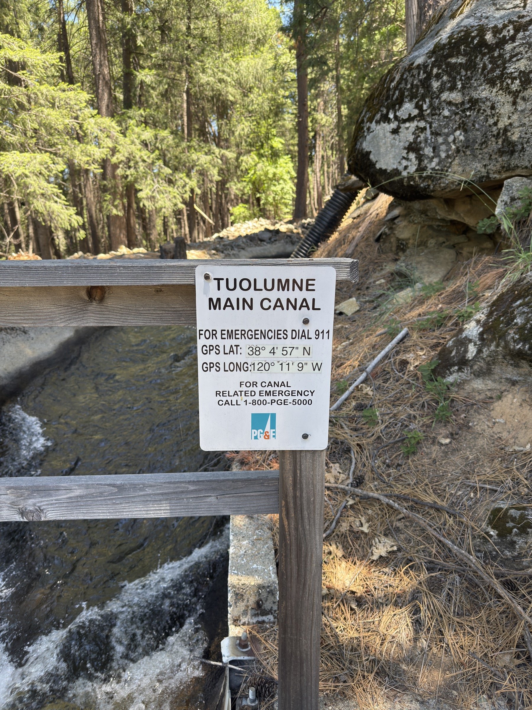
There were no warnings that we could see, but the water that flows is for human consumption in towns like Twain Harte, so no one should jump in the water or contaminate it in any way. Cassie and I openly wondered why no one was running a canal float business on the flume, and now it makes sense why there isn’t one.

What I Learned
Walking on planks on top of flumes was a unique experience and one I’m not sure I’ll be able to experience in a different place. I’m grateful I found this place and got to experience something new!
I don’t usually think of dams as cool places to go (I’m much more interested in naturally created things), but being so close to the bottom of the dam and looking up while water was flowing all around us was an intense experience and one that I quite enjoyed.
Some parts of the flume were built in such a way where thin slabs of concrete were used to move the water downstream. I never thought concrete would be used for something like this and it genuinely blew my mind.
I learned that over this previous winter, parts of the canal were damaged due to snow and had to be repaired with urgency as it meant a loss of water for towns downstream. We could see the parts that were new and other parts that seemed like they were original. It was so cool walking on a historical achievement.
What Happened?
9.5 miles, 3 hrs 46 mins, 224 ft of ascent
I had learned about this canal through an Instagram post and what I saw was interesting. There was a hike where you got to walk on top of a canal for miles and it led to a swimming hole? It took me about 30 mins or so to find the trail and our weekend plans had soon changed. I had actually spotted a flume near Salt Springs Reservoir a decade back, so I thought it might be near there, but it turned out to be much more south than that.
I found the trail on AllTrails and it was a 12+ mile trail near the town of Twain Harte; however, because we had woken up late, we decided to shorten the hike by a few miles. So, instead of parking at the trailhead, we parked more than a mile into the trail when it crossed a public road. We parked in the neighborhood next to the canal and we were off!
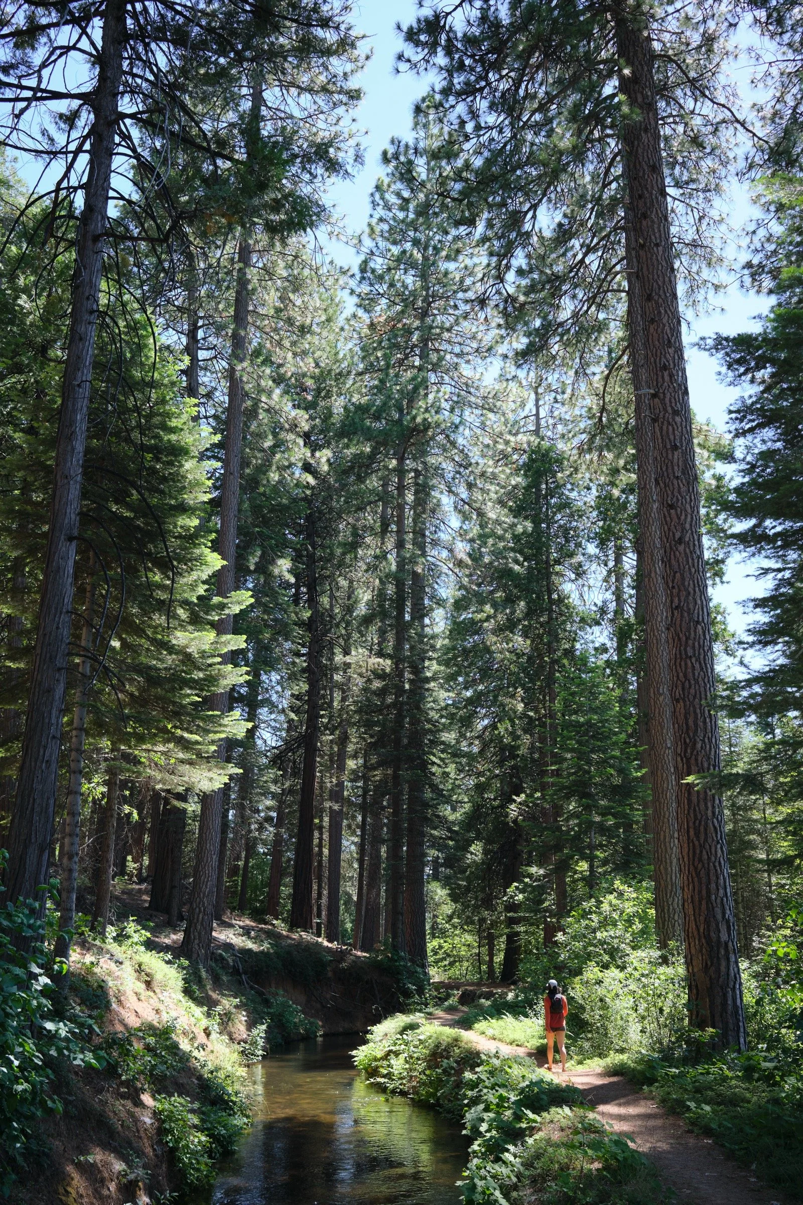
We were pretty much wowed the entire way to the dam. For the first few miles, we were wowed by how green the trail was. Because this part of the trail has the canal running through a long ditch, we saw a ton of green as trees and other vegetation feasted off this clean water. We were walking under so much shade and the trail was just a beautiful mix of bright greens and earthy browns.
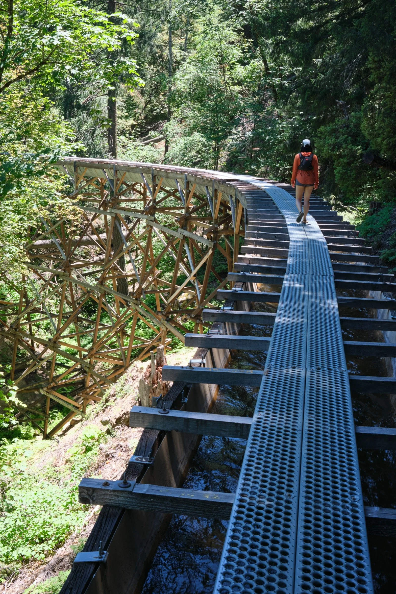
Then, the canal started to be supported by wooden beams as it needed to be raised off the ground. The way the canal works is that there is a small but constant loss in elevation from the dam to the cities it feeds, so to make sure the water flows, the engineers back in the 1850s built these wooden structures to raise the water. And what I suspect is that to build and maintain the canal, they built a walking trail that went on top of the flume.
Some parts of the flume were 5 feet off the ground, and over some creek or road crossings, the structure was at least 50 feet tall, if not more. For me, the first time I walked on top of this structure over such a height made me anxious and a bit of vertigo. However, I just kept my eye a few feet in front of my toes and focused on a steady and rhythmic walk. And every time we went over a tall section, it got easier and easier. And I think on the second tall span, there was a friendly lady that was sitting on the plank in the middle of it. She saw us coming and moved off just enough so that we could pass while still walking on the plank.
And when we got to a mile or so of the dam, the entire hike became a walk on the plank. The canal wrapped itself around the steep canyon surrounding the dam, and we didn’t touch earth until we got to the dam itself. And what a dam it was.
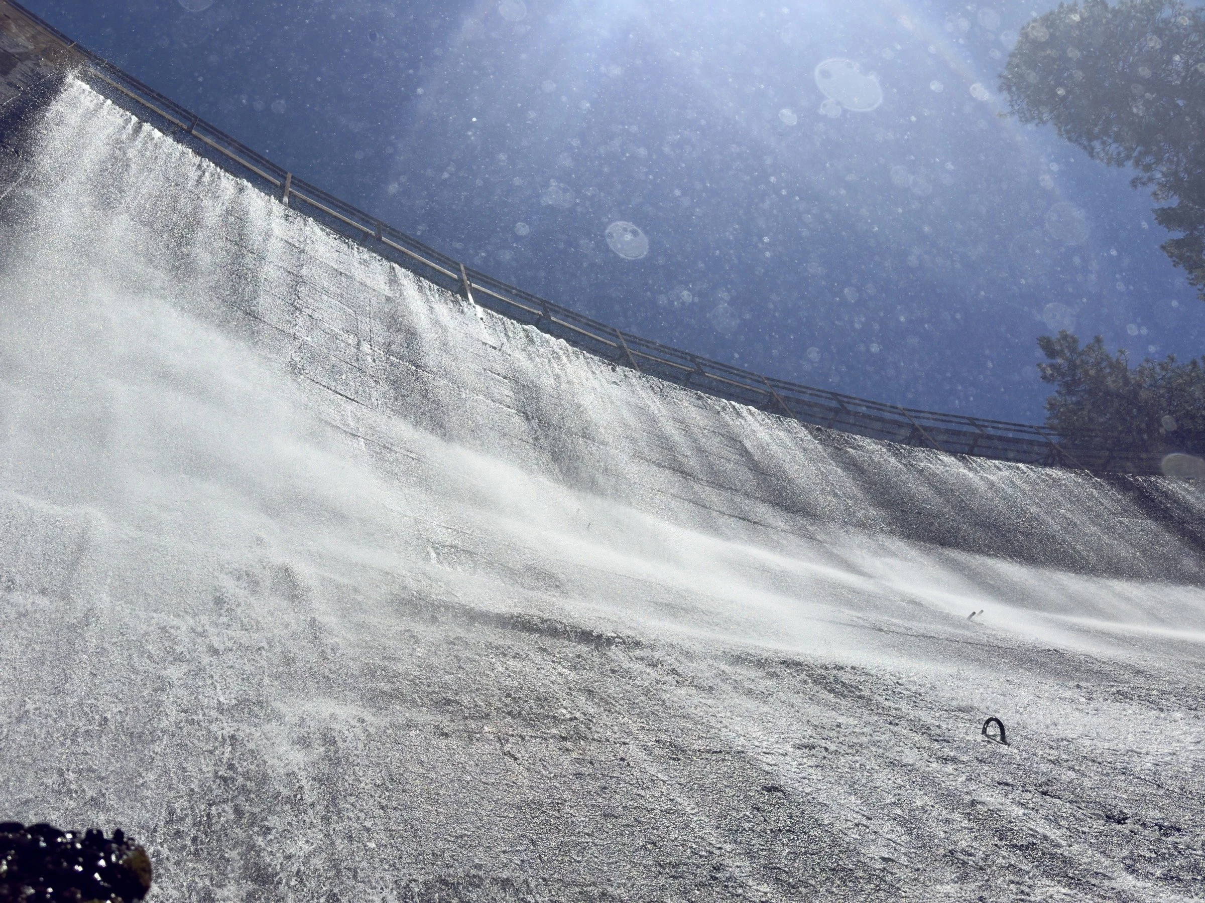
Because we came in the spring and because there was more water than the dam could sustain, there was a whole lot of water spilling over the top of the dam, as well as a strong stream of water being discharged at the bottom of it. And we took advantage of a walkway that let us get right up to the bottom of the dam. Especially since it was a warm day and we were a bit hot, the drizzly water that fell on us was more than welcome.
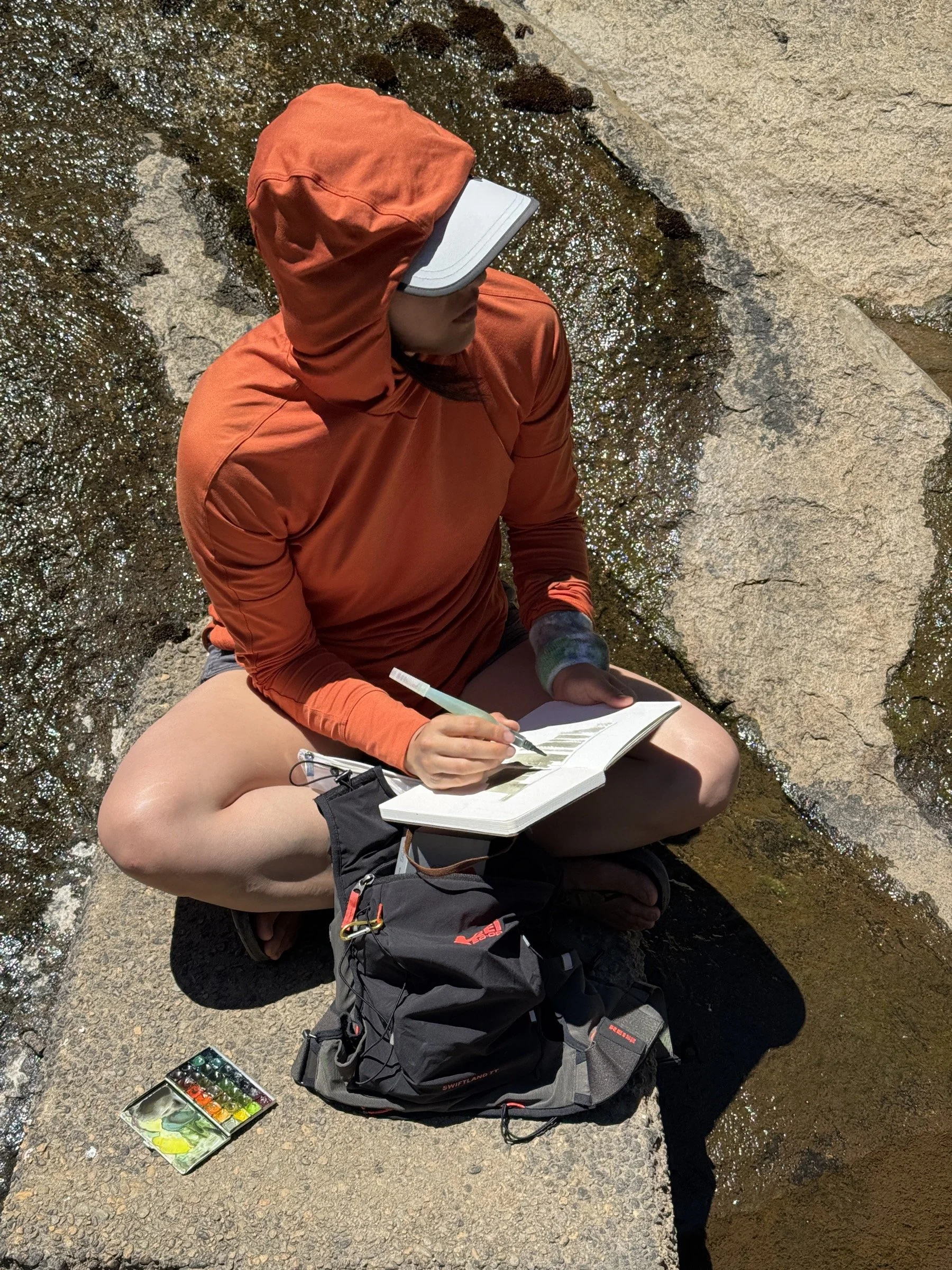
We then sat down to eat our sandwich, and afterwards, Cassie spent a good half an hour painting while I read under the shade of the flume. We then took a dip in the South Fork Stanislaus River and hiked back. The hike back was a whole lot hotter, but we made it back to the car in good spirits as we still felt very lucky to have had such a unique hiking experience.