Mt. Tam Circumambulation

Hike Review
Cassie and I parked our car at the Bon Tempe Lake Trailhead, then hiked in a clockwise fashion around Mt Tamalpais. We hiked via the Sunny Side Trail, Alex Forman Trail, Lakeview Fire Road, East Peak Fire Trail, Eldridge Grade Fire Road, Wheeler Trail, Hoo-Koo-E-Koo Fire Road, Old Railroad Grade Fire Road, Rock Spring Trail, Lagunitas-Rock Spring Fire Road, Lagoon Fire Road, Stocking Trail, Rocky Ridge Fire Road, then finally, Bon Tempe Dam Road.
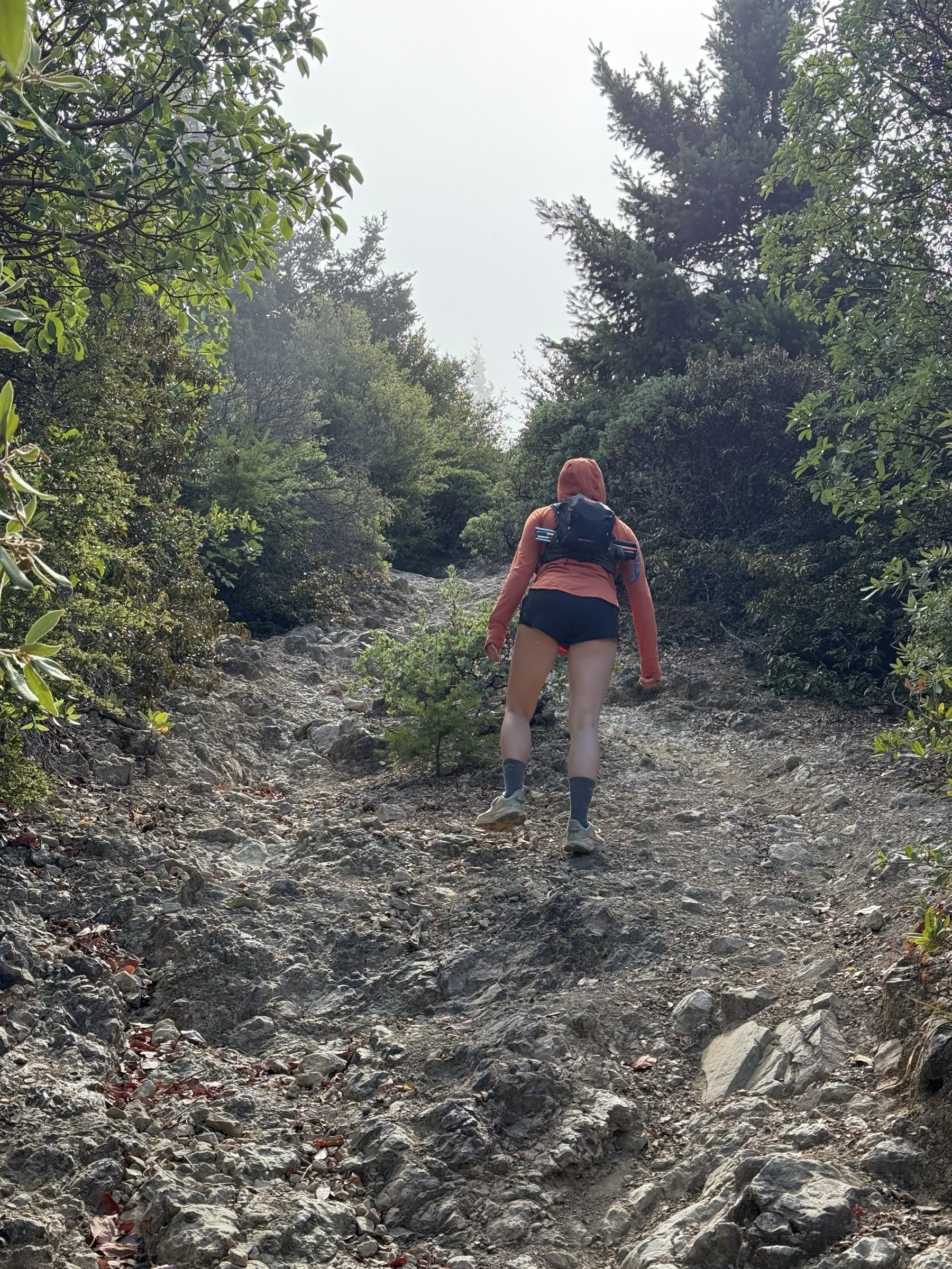
In the above listing, all the trails that ended in “Road” were double-track fire roads that were nicely graded and shared with cyclists and equestrians. Everything else was a single-track trail meant only for hikers. Of note, East Peak Fire Trail and Wheeler Trail were very steep trails with lots of scree in specific parts. East Peak Fire Trail would have been especially difficult going downhill, and I would only recommend going uphill on that trail.
The trails were extremely clean with almost no sign of trash.
We only had to share the trail with a few others on this windy day. Still, we only saw people near the Bon Tempe Lake, Lake Lagunitas, Eldridge Grade Fire Road, Hoo-Koo-E-Koo Fire Road, Old Railroad Grade Fire Road, and at the very beginning of the Lagunitas-Rock Spring Fire Road. In certain parts, we hiked for hours without seeing another soul. Also, the north side of Mt Tam has less than 10% of the number of people we saw on the south side.
Because it was such a windy day, we did not overheat. Unlike what I expected, we were pretty chilly when we hiked downhill and when we took a break at the West Point Inn.
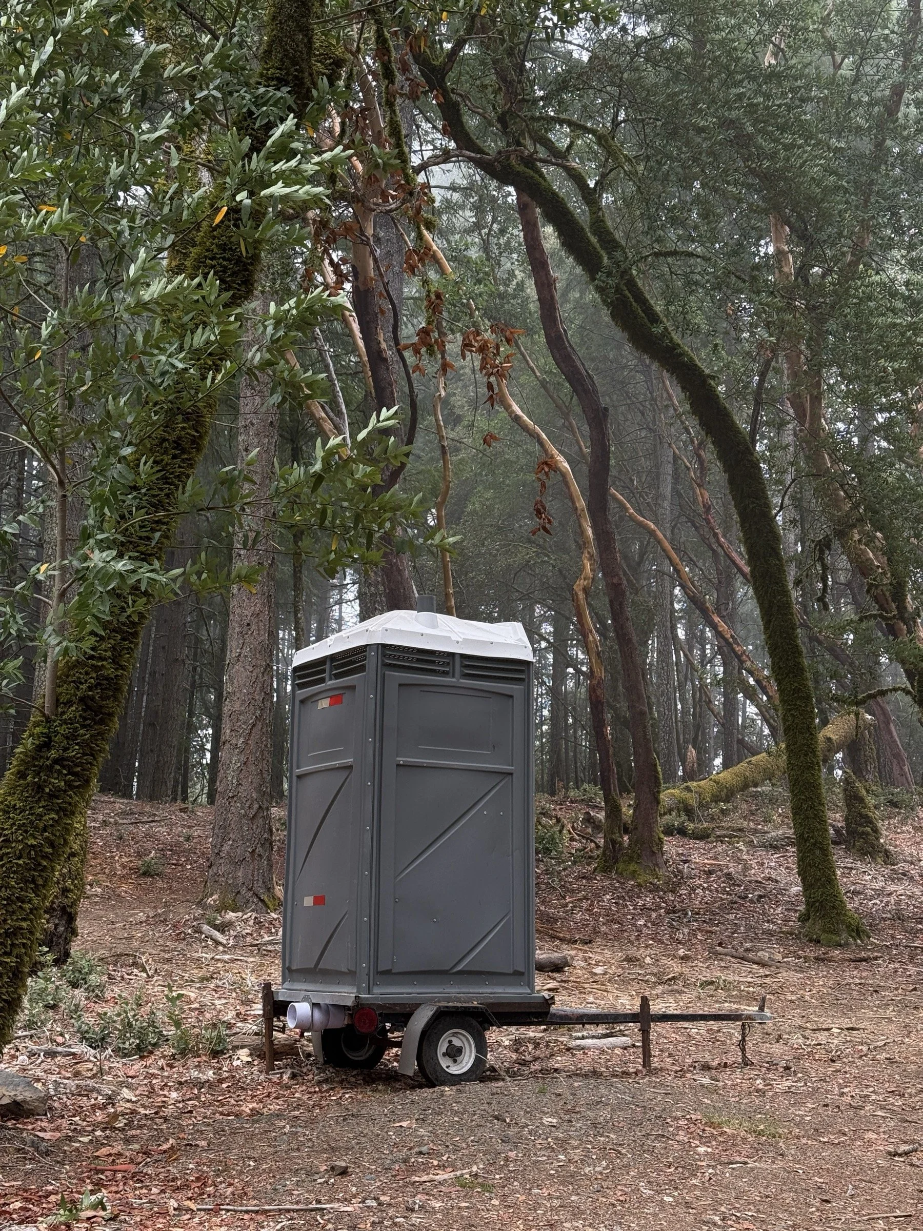
There were plenty of bathrooms well spaced on the hike. Both lakes had parking lots with bathrooms, the West Point Inn had a clean bathroom (and a portable toilet near the trail), and there was a random portable toilet at the start of the Lagunitas-Rock Spring Fire Road.


What I Learned
We had to turn back after half a mile because we had forgotten the sunblock. We then applied the sunblock and continued our hike. Even with the sunblock, I got a bit toasted by the end of the hike. Next time I need to remember to reapply after a few hours.
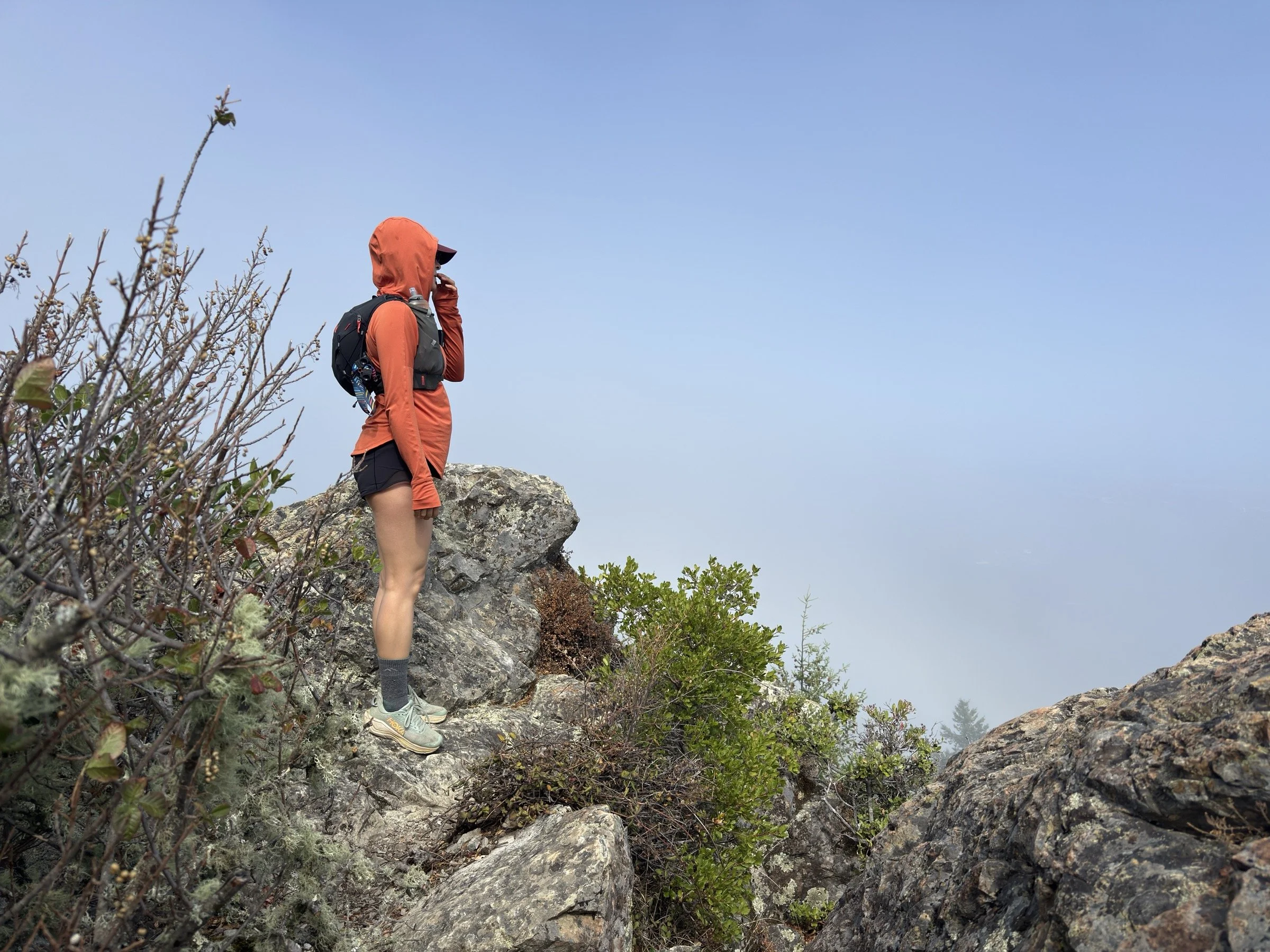
When hiking the ridge line that led up to the Mount Tamalpais East Peak, the wind blew fiercely and almost blew my hat off a couple of times. I think before this day, if I knew how windy it would be, I might have stayed home. But I learned to appreciate the wind as it kept me nice and cool for the ascent. Instead of overheating, I had a great time hiking up at a steady pace. The only downside was that the views from the top of the mountain were obstructed by the all-day fog that hid the top half of Mount Tam.
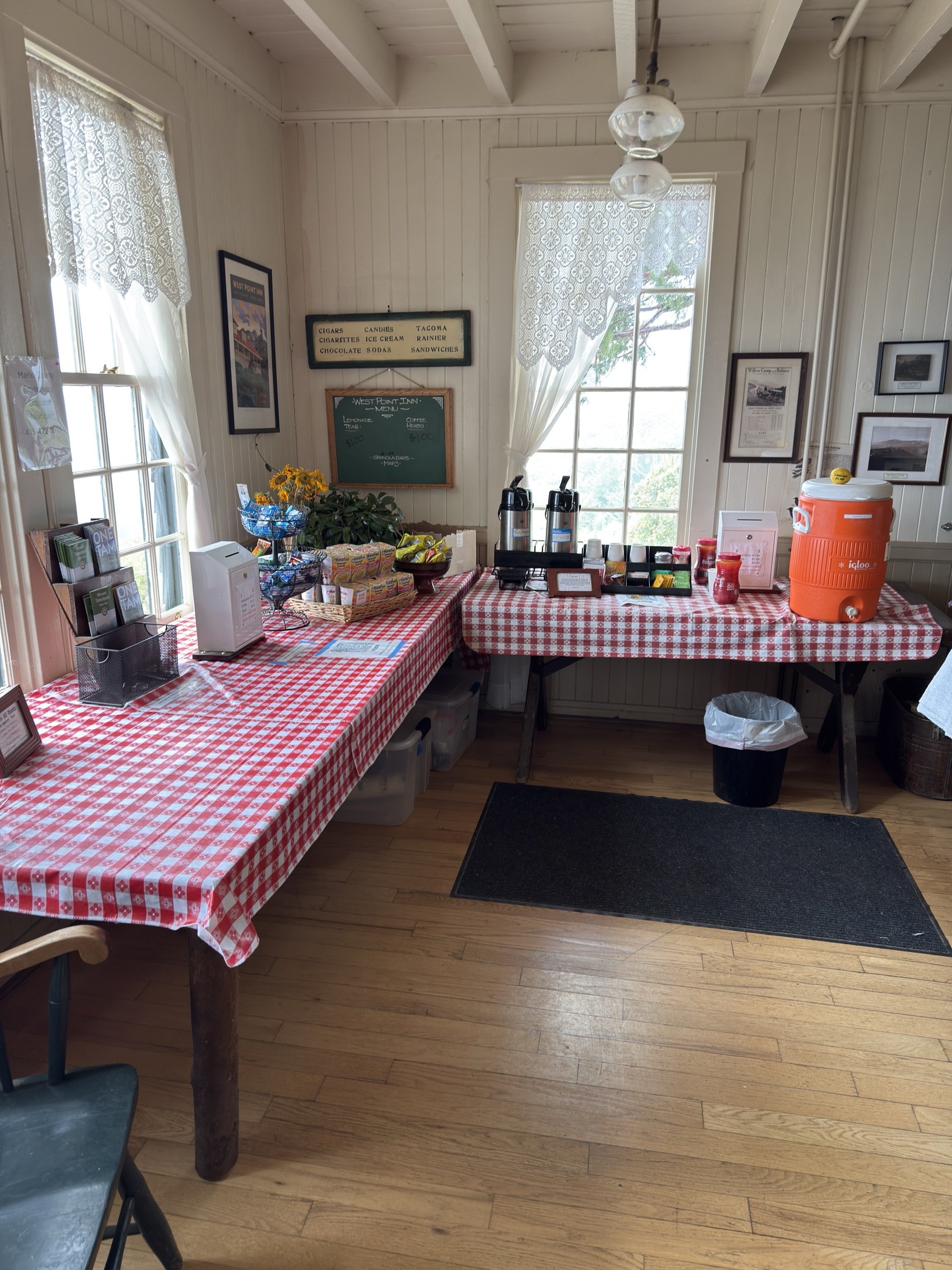
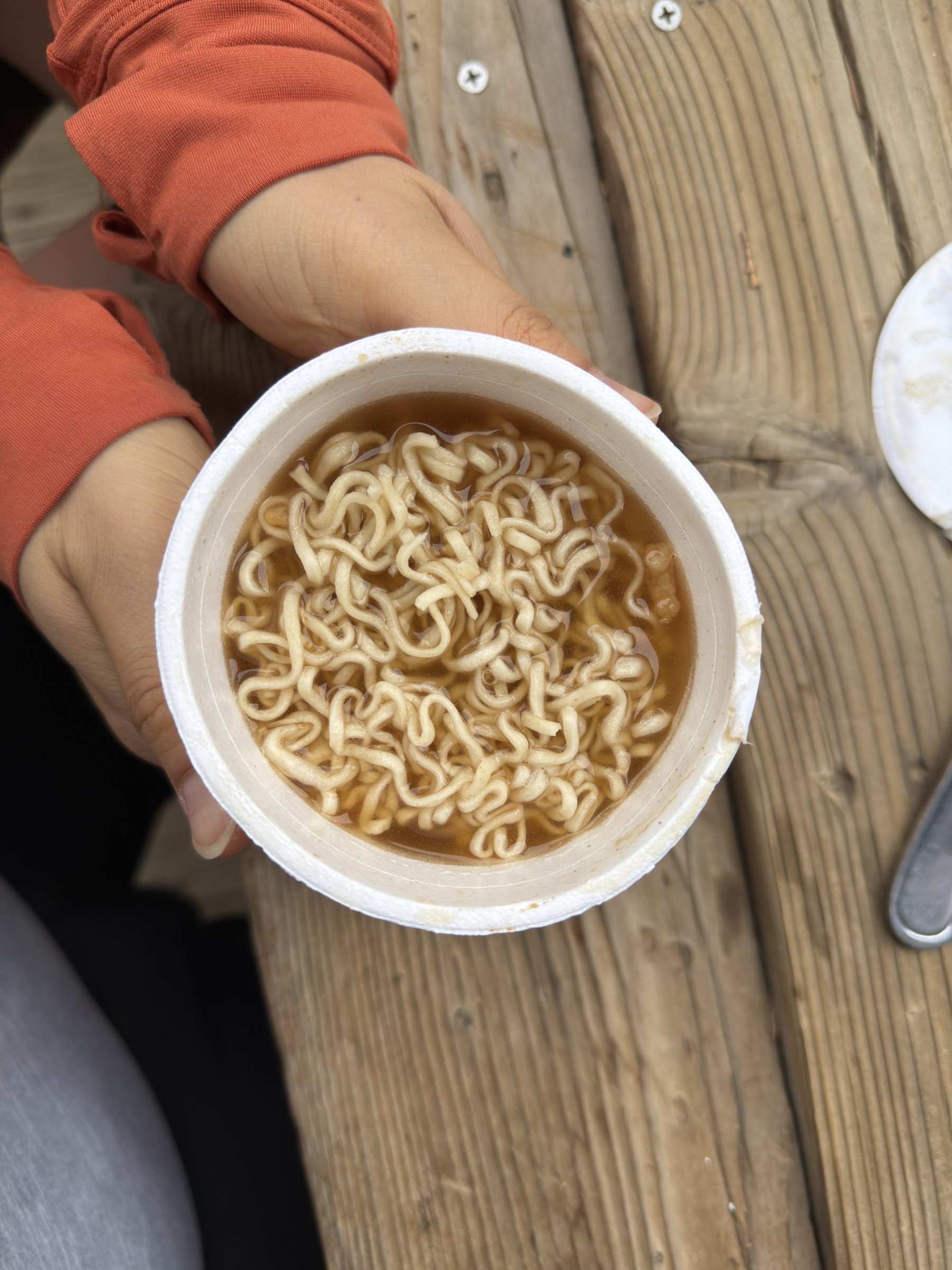
On a long hike, salt gets more and more delicious as I’m on the trail. On this day, just about at the halfway point, we stopped by the West Point Inn. Last year, when Cassie and I hiked to the East Peak from Stinson Beach, we found out this Inn sold ramen to hikers. At that time, we didn’t eat anything. On this day, I paid $2 through Venmo and had myself a Shrimp Maruchan cup ramen (the inn had two hot water dispensers). There were no chopsticks or forks, but when we asked the hotel guests where we could find a fork, they directed us to the off-limits-to-hikers kitchen. The ramen was oh-so-delicious as I craved salt. On the next hike, Cassie and I are now thinking about packing ramen and hot water in a thermos. Of course, I washed the fork before leaving the Inn.
Near the end of the hike, my Apple Watch reported that we had gained 3950 ft of elevation near the end of the hike. A part of me wanted to hike another 50 ft by repeating a bit of the hike. But I decided against it as it seemed too silly and arbitrary. This is of course coming from the same person that rode 2 extra miles in a loop to do my first century bike ride two weeks ago. At the end of it, when I uploaded all the data to Strava, it told me I had gained 3575 feet of elevation gain (Cassie’s Garmin watch reported 3251 feet).
It just so happened that the route I chose for us utilized a single-track trail for going uphill and a fire road for going down. This worked out really well as the single-track trail would have been too slippery to go down without slipping and falling. At the same time, I prefer some variety in my hiking as hiking a fire road the whole day can get really boring. So, in the future, I think if I have the option, I’ll stick to going uphill on trails and going downhill on fire roads.
Our shoulders were a bit sore the next day, so we probably should have taken an extra break or two. Next time, maybe I’ll try taking a 5-min break at least once every two hours.
What Happened?

15.4 mile, 7 hrs 33 mins, 3575 ft of ascent
Cassie and I had taken it easy this summer. With Cassie making great progress on her leg recovery, we decided to hike something a little less than 15 miles and 4000 ft elevation gain. This removed many of the hikes that I had wanted to hike in the Sierras, but it did make us look north to the familiar Mount Tam.
Over the summer, I read my favorite book of all time, “The High Sierra: A Love Story” by Kim Stanley Robinson. In the book, there is a mention of the “CircumTambulation.” Started by poets Allen Ginsberg, Gary Snyder (who led Jack Kerouac up Matterhorn Peak), and Philip Whalen in 1965, circumtambulation refers to the circumambulation of Mt. Tamalpais. This sounded cool to me, so I had mapped out this hike earlier in the summer. However, the official route starts in the crowded Muir Woods National Monument and goes to the top of Mount Tamalpais East Peak, which didn’t seem like a circumambulation to me. So, I changed the start to Lake Lagunitas, and made sure to avoid the three peaks of Mt. Tam. The night before though, I changed the start to Bon Tempe Lake to add another lake to the hike for the cost of 2-ish miles and a few hundred feet of ascent.
We started the hike at a great pace and feeling very prepared. We had the exact amount of water we needed, a bunch of snacks, comfy shoes, wool socks, hiking poles for Cassie, running shorts, etc. However, we had to turn around after more than half a mile as we totally forgot our sunblock! After retrieving it and using the restroom, we restarted the hike and quickly made it past the two lakes.

I initially missed the start of the East Peak Fire Trail as there was no signage, but we hiked back the few hundred feet and found the unassuming trail. This trail is not one that is hiked often, as we found the vegetation doing its best to try to recover the trail from the humans. We constantly scraped by bushes and manzanita trees as we slowly made our way up the mountain with the wind and the fog howling above us. And as we got higher, we started feeling a damper until we were completely swallowed by the gray. The trees may have thrashed above us, but the thick bushes kept the harsh winds away from us. This was truly a case of nature talking tough, but not quite delivering.
The trail finally intersected another, and we decided to follow that to the south side of the mountain. I was hoping that we would be done with slippery scree that made up the majority of the East Peak Fire Trail, but when we got to Wheeler Trail, we got to go down some slippery stuff. Thankfully, Wheeler wasn’t as bad as the other, and we made it down to the fire road without falling. For the next 2-3 miles, we stayed on the fire road to the Inn and regained all the elevation we had lost (and then some). Whenever the trail had a direct line of sight to the ocean, we would get hit in our face with fog and fine-dirt from the trail; whenever we had the mountain the way of the ocean side, we would have totally calm conditions. This Jekyll and Hyde show continued all the way up to the West Point Inn, where we rested, and I chose to eat a cup of ramen.
When we got ready to go, we knew we were halfway done with the hike and that the rest of the hike would be mostly downhill. Both of us had drank a liter of water, and I refilled half a liter for myself while Cassie refilled another liter of water.

The rest of the hike was less memorable as it was mostly on a fire road that was nicely graded. Also, the winds were far less fierce on the northwest side of the mountain, so much less drama. The coolest thing though was that while I had planned to take fire roads all the way down, but on a whim, decided to go down to Serpentine Knoll, then take the Stocking Trail back to Rocky Ridge Fire Rd. There wasn’t much to see on Serpentine Knoll, but on the Stocking Trail, we ran into a young redwood forest that was the most densely packed forest I have ever been in (besides a bamboo forest). Actually, the density of trees reminded me of a bamboo forest. This totally unexpected forest was a delight as we hiked down to the lakes.
Sooner than later, we were down to our car, dreaming about the amazing dinner we were going to have. After having debated the dinner choice for most of the hike, we decided on Korean BBQ and headed to Steve’s BBQ in Berkeley. If you’re curious, the runners-up were jjajangmyun in Oakland, Indian food in Berkeley, Panda Express (anywhere), and Amy’s Drive Thru in Corte Madera.