Mount Watson Boulevard

Route Review
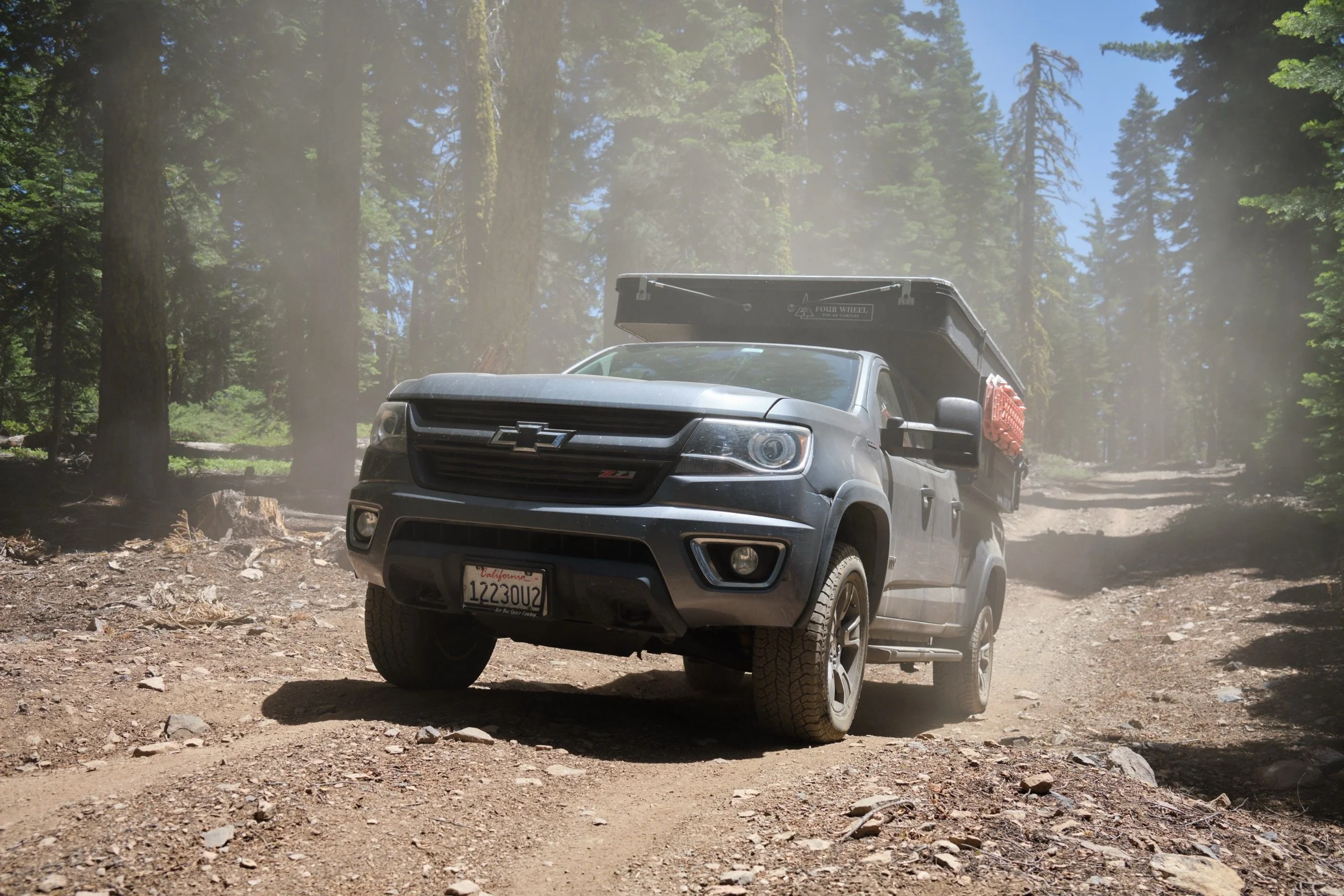
Mt Watson Drive is an off-road dirt road requiring high clearance and expert off-road skills (or high clearance, 4x4, and novice off-road skills). However, after a few miles from Tahoe City, the dirt becomes paved, and the ride gets smooth. Which was perfect for Cassie's knee, which is still slowly recovering from an overuse injury. We parked on the side of the road and decided to ride our bikes a few miles and see how Cassie's knee felt.
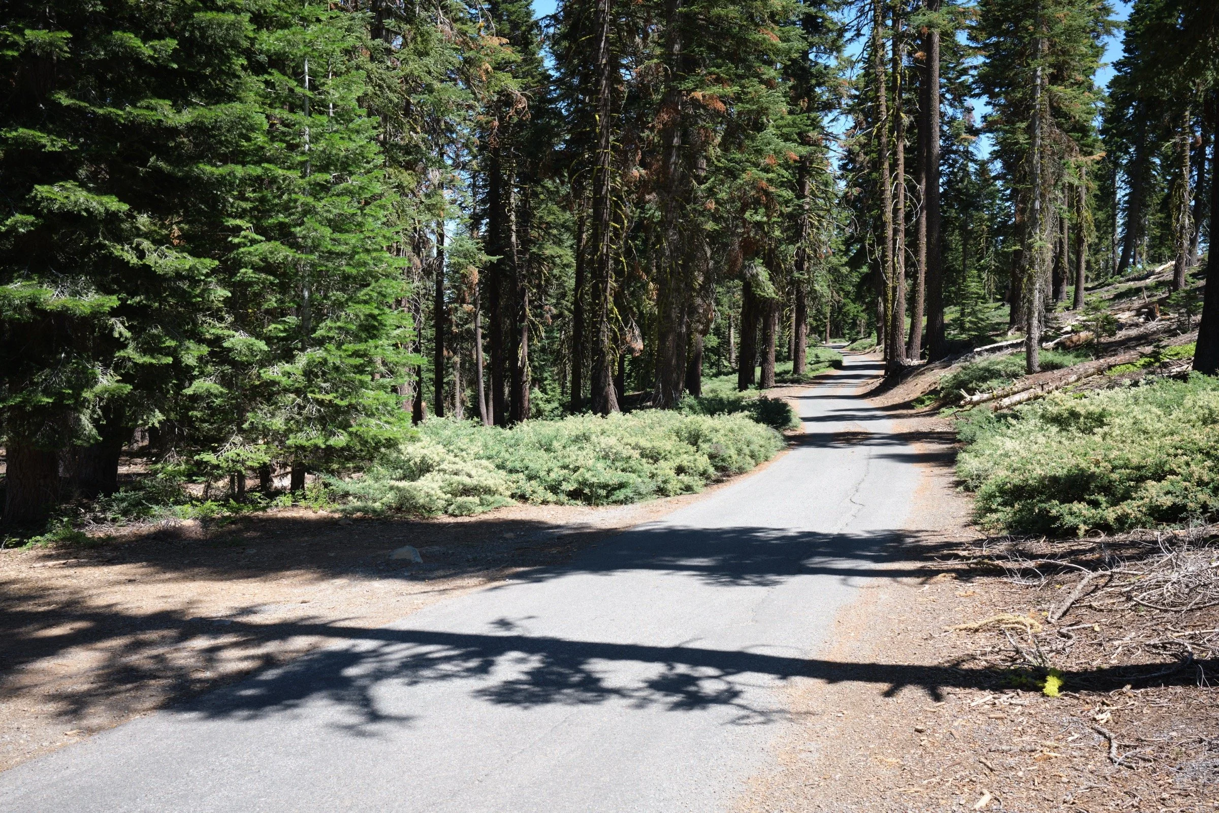
The paved path has a few places where there are potholes, but they are easy to avoid. The rest of the road is as smooth as a forest road can be (at least from my experience). There is plenty of shade from the evergreen trees that stand everywhere one’s eyes can see—this is a beautiful path and a great way to enjoy the Tahoe National Forest.
There is vehicular traffic on the road, but they are rare. Even more rare are other cyclists (mountain and road) and runners.
Because it's a forest road, the main sounds I heard while cycling were of birds and the trees as they were being blown around by the wind.

What I Learned:
Both Cassie and I hit our max heart rates (for her, mid-170s; for me, low 160s) while cycling, and I was a little surprised given that the ride did not have super steep grades. But I think it's because we were at elevation and we weren't acclimated to the altitude yet.
What Happened?
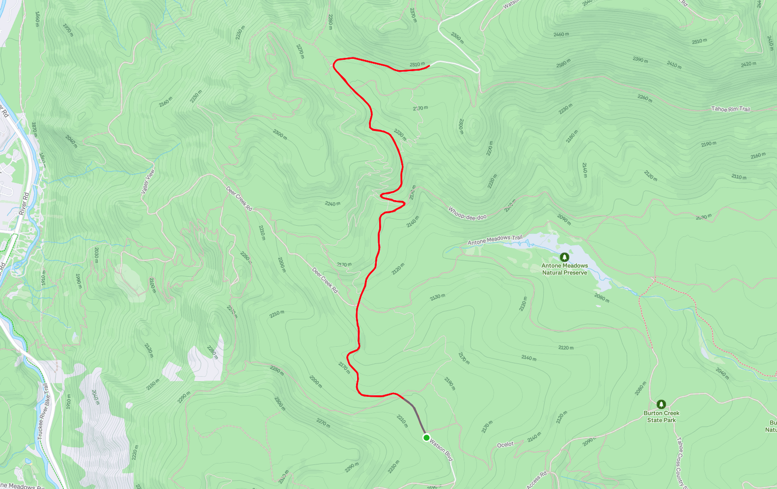
5.8 miles, 50 min, 847 ft of ascent

It was a super windy day, which made the felt temperature about 10 degrees colder than the perfect mid-60s that we felt from the wind. So, instead of going rafting, we decided to check out this road that I had found a few years ago and see if we could bike the paved section of this road. I had remembered Mt Watson as an easy forest path, but there were two distinct sections that were much harder than I remembered and where I turned on 4x4. There was also a ton of dust that we kicked up; we had fun with it to see if we could look like Ramona and look extra tough as I ran around taking photos of the car before the dust could settle.
When we got to the paved section, we found a pullout and got ready to cycle. We changed clothes, put on sunblock, and started pedaling. The path lost about 200 ft of elevation almost immediately, which worried me since Cassie's leg was unproven, but she was feeling good, so we kept going. The next 20 minutes or so was pure uphill, so we changed to the lowest gear and went as steady as we could. After about 3 miles, I was unsure if it was a good idea to keep going—we had gained about 500 ft and while Cassie's leg felt fine, would it handle the additional uphill that awaited us on the way back to the car? An injured leg would prevent us from doing a whole lot of fun stuff the rest of the weekend, so we decided to be careful and head back.
The way down went fast, as it usually does. We both rode our brakes almost the entire time—our mantra really was to be careful. The final uphill was about 200 ft of elevation or so, but it really wasn't too bad. Our hearts were working hard, but we were rather used to the uphill at this point. When I remarked to Cassie later that this was exactly the same type of cycling going up a mountain was, she was surprised that climbing a mountain was in her reach. I just told her that it was the same, but that we'd have to do what we did but maybe 2 more segments of the same length (Mount Diablo and Mount Tamalpais is about that distance and elevation gain).
Overall, the ride was a beautiful ride through a dense forest and we loved it. No one got hurt, Cassie got to prove her legs, and we both had a great time; even if we did not reach Watson Lake. After we had stowed our bikes in the car, we drove to Watson Lake, remarking how cycling allows us to appreciate how hard the car works on the uphills and makes it oh-so-easy.